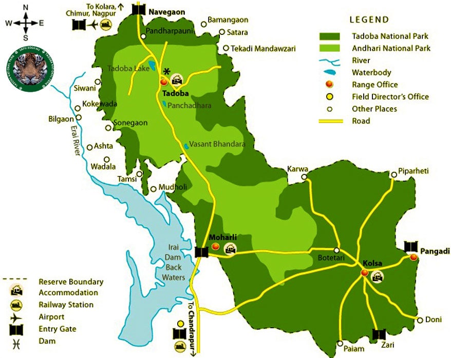

Here we elaborate Taoda National Park tourist map in detail that may help you navigating here while touring in Tadoba Tiger Reserve. It will also help you in understanding the entire geographical stretch of TATR. Studying this map will take you to the virtual tour of the Tadoba Andhari. Before exploring any vast region if you go through the tourist map certainly it help in making better understanding of the jugle area and prepares you to take every precautionary measures while enjoying jeep and cater safari in core or buffer area of the Tadoba National Park. The detailed map of Tadoba depicts everything such number of tourism zone and their entry points, distance from major cities and best route to reach Tadoba.
Tadoba Tiger Reserve or national Park is largest national park of Maharashtra state sprawl over an area of 625.4 square kilometers comprising the area of Andhari wildlife sanctuary. The area of tiger reserve also includes 32.51 square kilometer of protected forest and 14.93 square kilometers of uncategorized land. The tiger reserve area covers the Chimur Hills. The 120 hectares of southern west is Tadoba Lake which plays a role of buffer between the Park Forest and extensive farmland. For detail study the geographical map of Tadoba National Park.
Tadoba National Park